THE ROUTE
Sydney to Brisbane January 5 through 14 2009
Brisbane to Thargomindah: January 15 to January 26 2009
Thargomindah to eyre Peninsula
January 27th through February 7th 2009
Port Lincoln (South Australia) to Geraldton (Western Australia)
February 8th through March 7th 2009
Geraldton to Broome (Western Australia)
March 10th to April 10th 2009
Cape Leveque and Gibb River Road
April 14th through April 28th 2009
We are greeting all of you today from the eastern end of the Gibb River Road and the Camp Ground at Home Valley Station, one of the film locations for the movie 'AUSTRALIA' in the eastern Kimberley region.
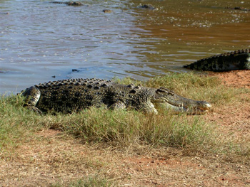
We left the tropical flair of Broome
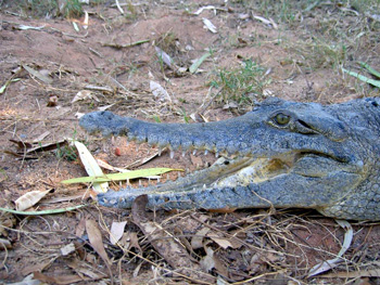
on April 14th after paying a visit to Malcom Douglas' famous saltwater crocodiles just outside Broome township.
A 200km track north on Cape Leveque Road
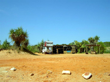
brought us to the tip of the Dampier Peninsula, the Cape Leveque. Here we found a wilderness camp called Kooljaman, which is owned jontly by two Aboriginal Communties.
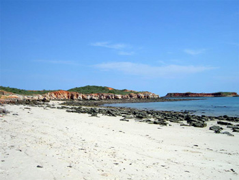
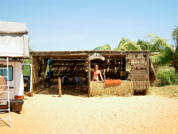
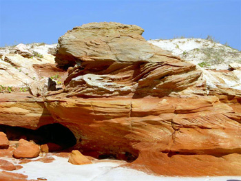
The area is very remote and pristine. The lush tropical vegetation of the surrounding hills meet the red sand and colorful rocks at the beach front. We rented one of the beach shelters right at the waterfront and enjoyed the warm blue ocean and the tranquility of the area for almost 2 weeks.
The shelter is constructed from bush poles and covered with palm fronds and grass thatching and has its own fresh water shower in one corner of the shelter to rinse off sand and salt after a long day in the sun. Previous guests had decorated our shelter with long strands of shells and coral, adding additional charm to our surrounding.
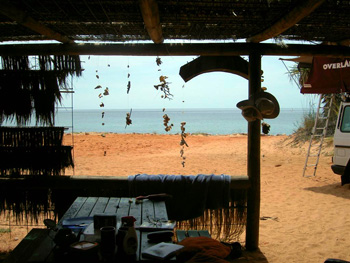
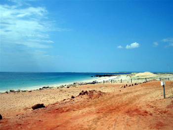
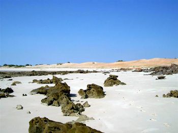
The beach lays at our doorstep and during some mornings wild dolphins swam close by the shore-line. The waterfront featured true Kimberley coast with red and white sandy beach dotted with rocky outcrops right to the waters edge.
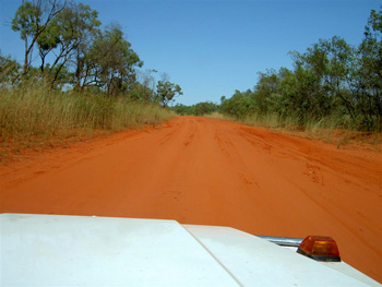
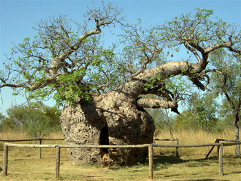
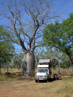
After 10 days 'in paradise' we headed for Derby and discovered that the Gibb River Road had just been opened for passage a few days prior. Of course we could not let this opportunity go by and we quickly changed plans and put the Gibb River Road back on our schedule. The original track was constructed as a stock route to transport cattle from central Kimberley Stations to the ports of Derby and Wyndham. It travels some 700km through the Kimberley Plateau and cuts across sweeping savanah plains and magnificent gorges. It is by now a wide gravel road, even sealed in some areas, and features endless variations of the Australian Boab tree. This one here was large enough to have been used as a prison tree for Aboriginals in the past.
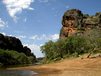
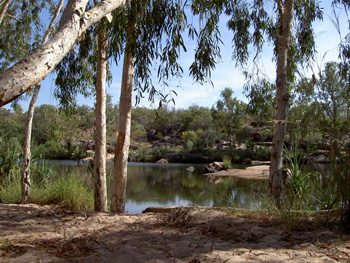
The gorges along the Gibb are magnificent, like Windjana Gorge, which was carved out of the limestone of the Napier Range by the floodwaters of the Lennard River.
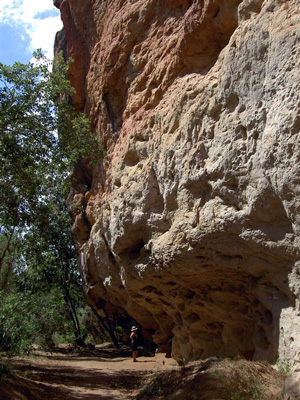
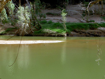
East Kimberley waterways are home to both fresh water crocodiles and salt-water crocodiles (adoringly named 'Freshies' and 'Salties' by local Australians). Of the two, the Salty is the larger one and the more dangerous to humans. We arrived on the Gibb River Road right after the end of the wet-season when all its rivers carried water and we were lucky to find some Freshies in the Lennard River at Windjana Gorge.
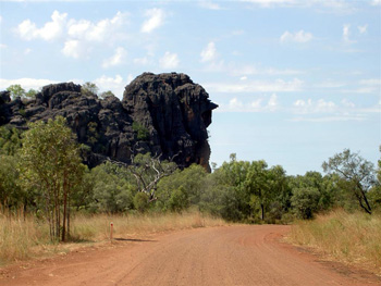
The road winds its way up and down some minor ranges and through interesting rock formations, such as this one aptly named 'Queen Victoria Head'.
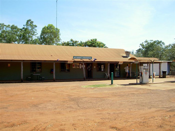
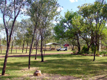
We made 300km on our first day on the Gibb River Road and pulled into Mt. Barnett Roadhouse for fuel
and a camp-site under an old Boab in nearby Manning Gorge with its permanent water hole.
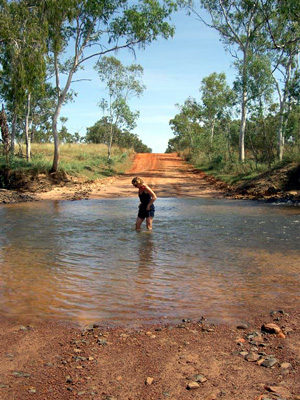
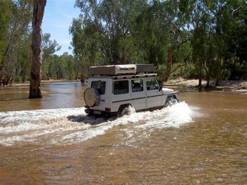
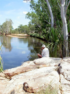
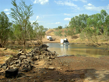
Waterways carve their way through the Kimberley region in a spectacular manner. Rivers and the associated wetlands have great environmental and cultural value in addition to being important ecological resources for water supply, agriculture, and fishing. Many rivers and creeks cross the Gibb River Road. After the end of the wet-season water levels should always be tested in person before a crossing is attempted. Here Gabi ist testing the water prior to our crossing of the Hann River.
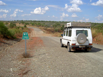
The distance to the next point-of-service or civilization is indicated by road signs, such as this one (250km to Wyndham).
There are many spots for a lovely lunch along the way. We choose the actual Gibb River itself, after which the Road is named (even though the river itself never actually crosses the road but runs about 3km north of today's route).
After lunch we had several water crossings ahead. The dry and unrelenting heat inside our car made a quick bath in some of them quite tempting. Here Martin had a refreshing dip right in the middle of the highway in the Durack River after testing the water level
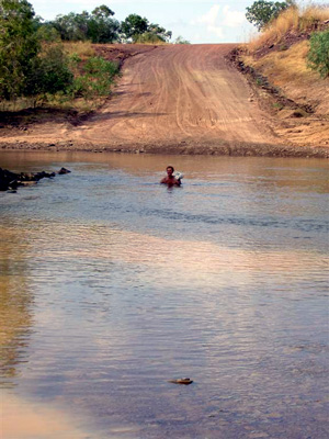
(Martin in Durack River prior to crossing). The depth of the water, however, poses no obstacles to hardy 4-WD Australians, who even pull their caravans through rivers, creeks, and over rough tracks, like these 'grey nomads' with their caravans.
We will be leaving the camp at Home Valley Station
at the foot of the Cockburn Range tomorrow. The place is home to huge flocks of shriking cockatoos and many large goanna.
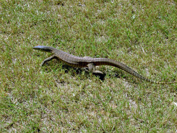
One of them was tasting Gabi's toes yesterday evening.
Our revised travel plans will bring us to the East Coast by the end of May after our 5000km trip through the interior. Should we have access to the internet before reaching Brisbane we will give you an up-date of the Canning Stock Route and our desert crossing. Hopefully we will be able to make some headway in our arrangements for shipping the car back from Brisbane in June. So far, from the Australian end, our efforts have been quite unsuccessful. So, unless we are lucky to get some help from the experts in the Old World, we may just have to stay on a little bit longer......(Just kidding)
Next Route:
Gibb River Road to Alice Springs
April 29th to May 15th 2009
February 8th through March 7th 2009
March 10th to April 10th 2009
April 14th through April 28th 2009
April 29th to May 15th 2009