THE ROUTE
Sydney to Brisbane January 5 through 14 2009
Brisbane to Thargomindah: January 15 to January 26 2009
THARGOMINDAH TO EYRE PENINSULA
January 27th through February 7th 2009
Current GSP Location: Port Lincoln S 34° 43' 40''
E 135° 53' 0.4''
PART A: Thargomindah to Flinders Ranges
On Tuesday January 27th we departed from Thargomindah under clear skies, carrying fresh water and food supplies plus 30 liters additonal fuel from the fake Shell Station. We headed for the desert pretty much simultaneously with a major heat wave descending into the region. For the next 2 and 1/2 weeks we journeyed south in the grip of this heat wave, with temperatures continually around 42-43 °Celsius during the day and even higher in parts of the desert country.In Thargomindah we said farewell to the flock of red-tailed black cockatoos
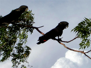
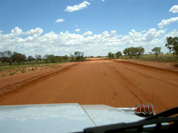
and took the laterite-red dirt road west to Innamincka.
Population became sparse and far-flung beyond Thargomindah, and the "entrance door" announcing the name of the next homestead
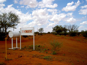
is miles away from the actual residence. We passed the Dingo Fence, intended to keep the animals in one part of the country and out of the other. Dingoes are considered a threat to the sheep industry. The Dingo Fence is the world's longest artificial barrier between 1.4 meters and 2.4 meters high and runs for about 5400km of man made fencing from upper Queensland in the north to near Ceduna in South Australia.
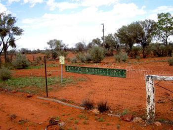
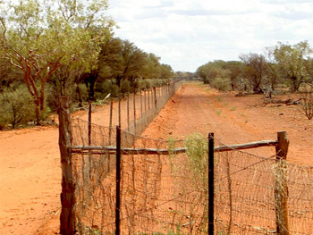
Dingoes are numerous north and west of the fence and less common in the other parts of the continent. We were heading on a good track in direction of Innamincka, a small outback settlement with a total of 12 permanent residents, lying at the head of the Strzelecki Track, which was our route south through desert country (Birdsville track still closed to all vehicles due to Monsoon rains in the north). The road traversed extremely arid country.
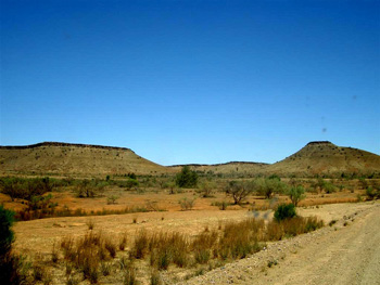
Shortly before Innamincka we entered South Australia and drove alone on the road over stony, flat tablelands
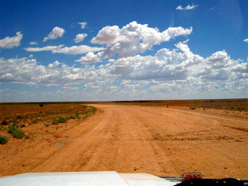
for endless durations of time, occasionally meeting a desert road train,
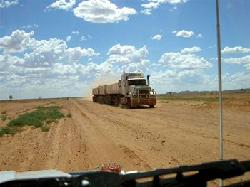
or passing a lone road crew working on the north-south track improvement out of Innamincka.
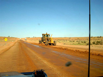
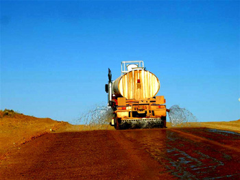
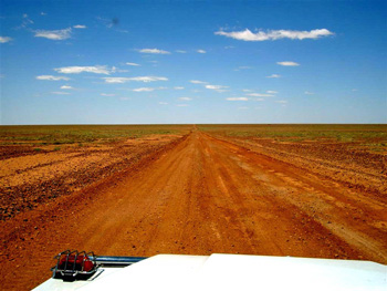
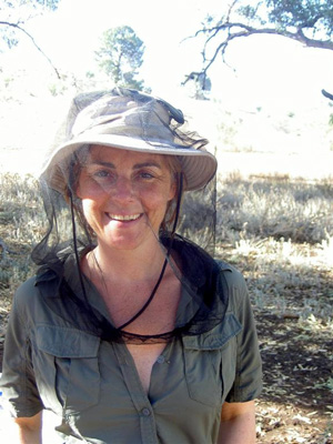
Along a fairly good gravel road with lots of hard corrugated surface and deep dust holes, (nice jumping about in the car of all kinds of things and not to mention the roof top gear box) we travelled south in extreme heat, often with up to 42° Celsius inside the car while driving (one of the rare occasions when Martin wished for an inbuilt air condition in the car!). The flies continued to be a pain-in-the-neck and really obnoxious, going straight for our eyes, mouth, nose and ears. And while we got used to the oppressive temperatures after a while, we never got used to the flies in the outback (but stopped complaining after a few days and just donned the mosquito net on our head and flapped about with our hands in the front of the face (also called The Bushman-Greeting!)).
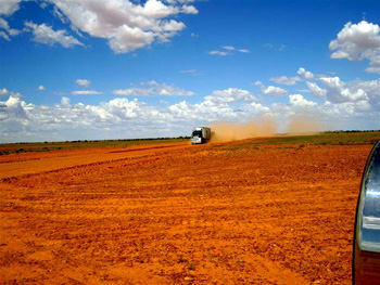
We travelled over vast empty stretches of land,
past the Moomba Oilfields
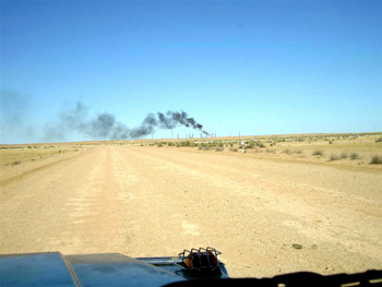
and did not encounter another vehicle for the next hundreds of kilometers until we reached Arkaroola at the northern Flinders Ranges. Along the Strzelecki track, we stopped for linear sand dunes stretching parallel to the track and some of us climbed the dunes in this heat!
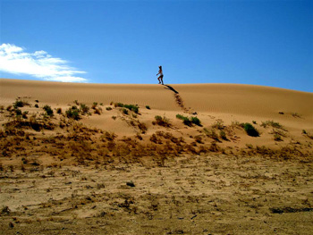
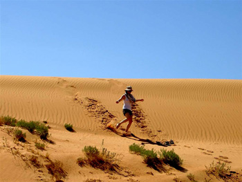
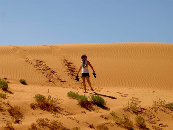
From here on, we were the only ones leaving tracks in the sand.
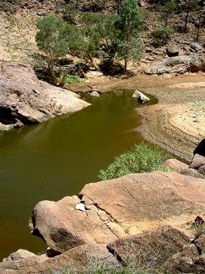
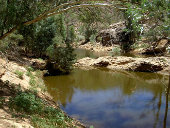
We found an unexpected relief from the heat, dust and flies at the Montecolina billabong (waterhole),
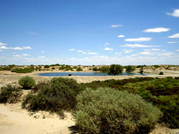
which is fed by underground water from the Artesian Basin (S 29° 24"3.3", E 139° 59' 15.1"). Our arrival caused up-roar among hundreds of white parrots, who huddled together in the shade of the pickinick areas and nearby shrubs.
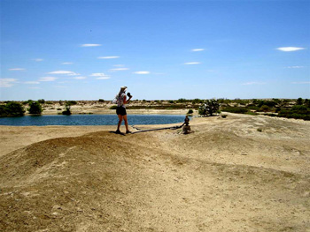
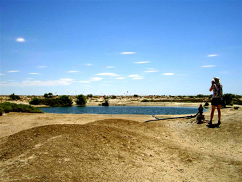
We had the waterhole totally to ourselves (but judging from the number of picknick tables around, this must be quite THE spot for tourists during winter months), and we jumped right into the luke warm pond.
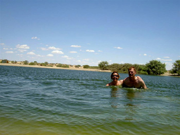
It had a very steep entry and the ground was covered with slippery algae making the exist somewhat precarious - but it was for us a pleasant spot in the midst of dry country!
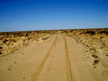
After the refreshing dip, we travelled on and eventually took a SHORT CUT of 180km length from the main track in direction of Arkaroola. The short cut (yes, it was called this on the traffic sign) was accessed via a station gate,
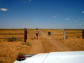
leading into the barren plains of a cattle farm. We did not encounter any cattle on the 180km stretch and also wondered what on earth the cattle would be feeding on in this area. But we did pass by the farm homestead,
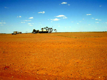
about 60km from the gate (quite a distance from your entrance doorway to your living room!) and got a taste for what is meant by 'the lonely life on outback stations'. Another 60km further on and we had reached the flanks of Gammon Range, the northern tip of the Flinders Ranges, and drove into tiny Arkaroola station just before nightfall. Up to now, driving had been fairly easy, the tracks recognizable as such, and the countryside flat. In Arkaroola all that changed radically: the area containes some of the most rugged mountain chains of the Flinders Ranges and with it some extreme 4WD terrain.
PART B: ARKAROOLA TO EYRE PENINSULA
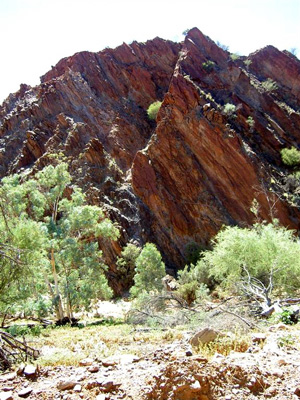
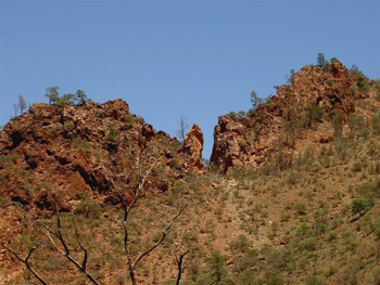
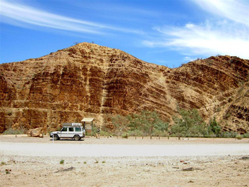
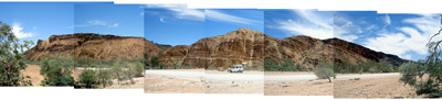
Arkaroola is a privately owned wild-life and nature sanctuary developed by Reginald and Griselda Sprigg containing absolutely stunning scenery and many geological features which are in fact recognized as rock monuments by the Geological Society. The area can only be explored by 4WD vehicles and on tracks with variable degrees of difficulty. An easier one leads to the Pinnacles,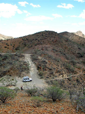

the remnant of a 480 Million year old volcano. Mildly tricky tracks
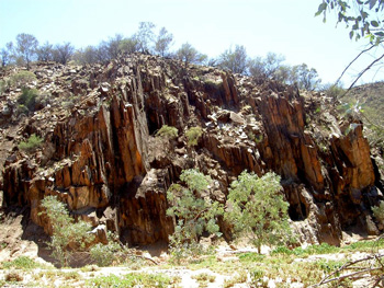
pass by hills which look like the local version of the egyptian pyramids,
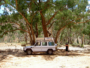
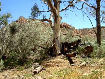
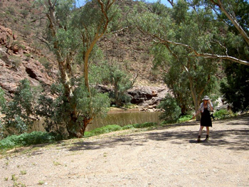
through dry creek beds dotted with old eucalyptus trees,
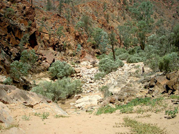
through rocky downs,
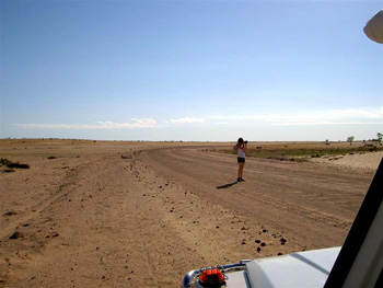
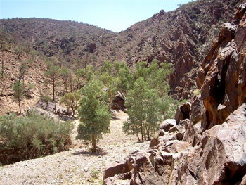
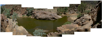
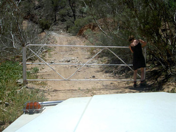
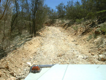
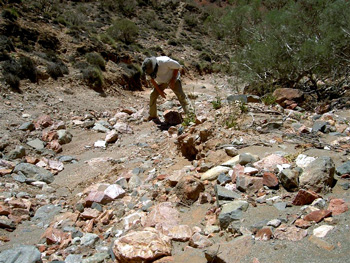
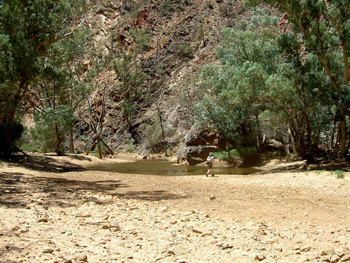
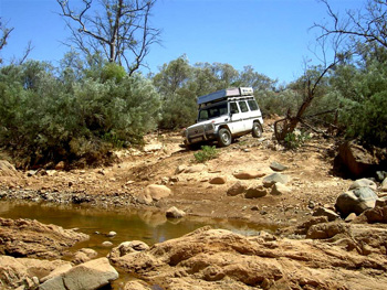
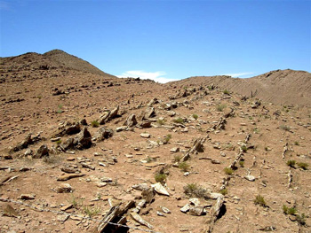
and finally into an area where we asked ourselves: 'Where IS the bloody track???'
In this picture you see Gabi standing to the right of rock boulders (in the mid-right part of foto, looking a bit like an old tree-stump), and scouting ahead to find 'the bloody track'. Eventually we realized that the track indeed continued inside the dried-up creek bed (middle right part in picture) littered with boulders and rocks, and we labored our way through it. The scenery was breathtaking: huge granite outcrops emerge out of the ground like the tip of the Titanic, and beside them old volcano chimneys rise up next to the track.
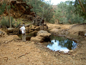
Interspersed in the rugged landscape are enchanting billabongs (waterholes)
and,
surrounded by rocky outcrops resembling fingers.
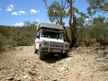
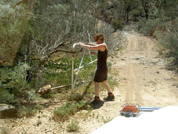
To reach the extreme section of the 4WD track, we were given a key to the gate (it is generally kept locked to keep unsuspecting travellers from making A Big Mistake). We opened and re-locked the gate after entering.
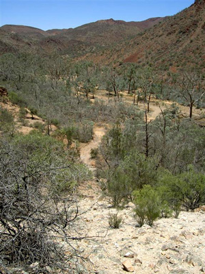
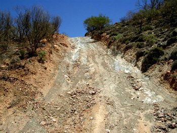
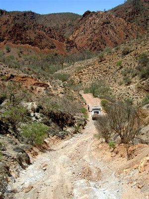
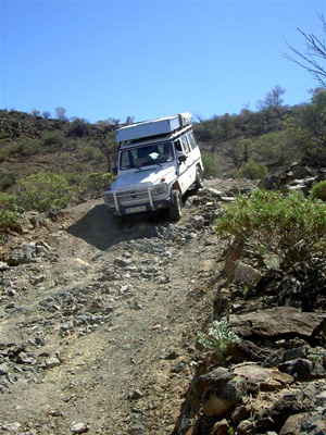
This track follows some adrenalin-pumping climbs and descents,
leading eventually into a dry creek valley.
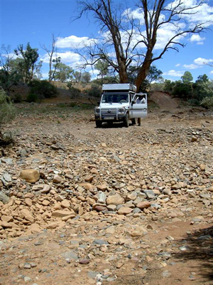
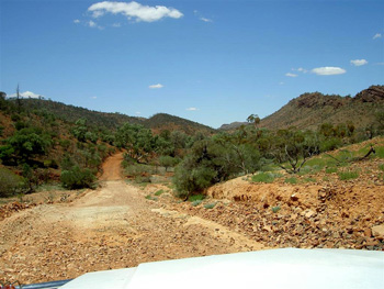
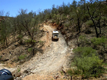
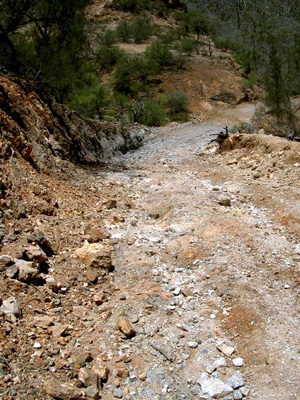
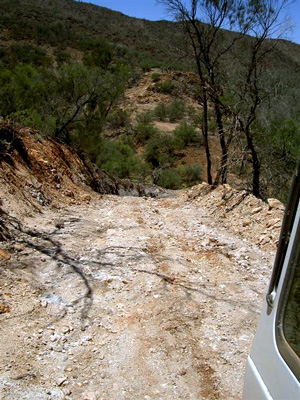
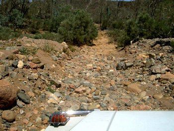
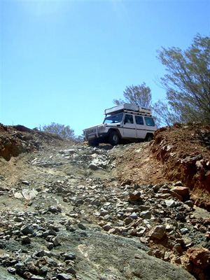
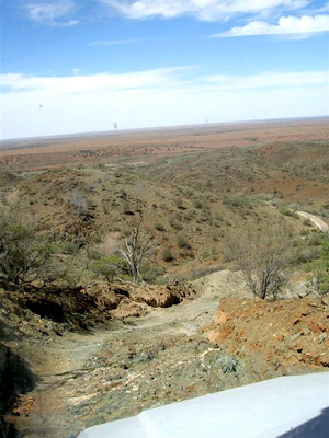
From here, the track took us down some very steep descents.
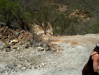
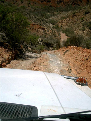
The pictures show the view of the downhill track. It continued in this rolly-polly fashion.
At times, we had to built the track,
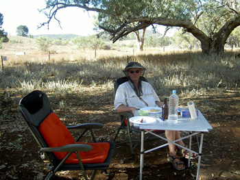
moving boulders and rocks out of the way to make room for passage, and to reach another serene billabong.
At one of them we had lunch, amidst millions of flies, requiring us to nibble on the sandwich under our fly mesh.
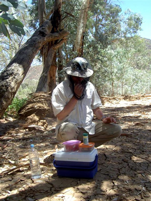
Thus nourished, we were soon on the road again, up and down the hillsides and through the creek beds.
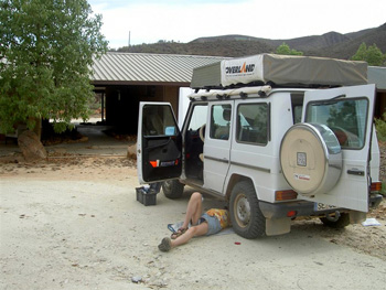
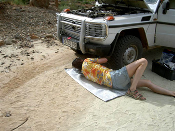
This 37km tour took us 6 hours to complete, and toward the end, ------- the brakes were gone! We drove back using the motorbrake in low gear and the hand-brake. Martin feared initially that the main brake cylinder was shot, and planned already a rescue call to his colleague in Hamburg, Michael Puls, to ship the spare parts to Arkaroola. However, the inspection the next day revealed that the damage was not as severe, but that the brake fluid had been boiling and that we needed to replace it. Martin did so during 42° Celsius and the many flies who came to watch.
Beyond the geology of the area, Arkaroola has also a privately owned astronomical observertory
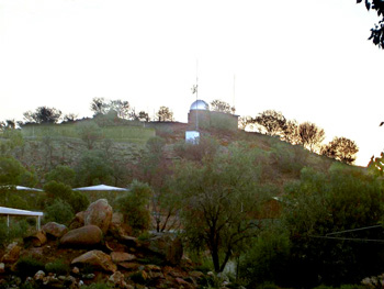
and some of the clearest skies in Australia. We had booked a star-gazing session with Doug Sprigg, who together with his sister nowadays manages Arkaroola station. It was a vastly memorable experience looking through the telescope: we looked at the other side of the Moon, at Venus, at a nearby galaxy deemed to be the birthplace of many stars, at the Magellanian Clouds (both minor and major), and finally at Saturn!
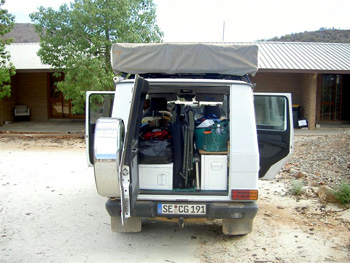
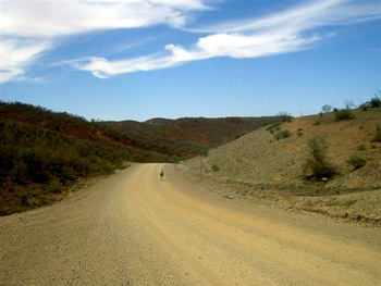
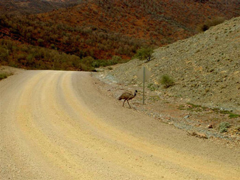
The next day we had packed the car,
and drove off with an Emu being the only other traffic participant.
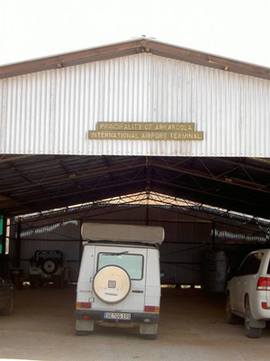
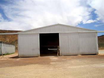
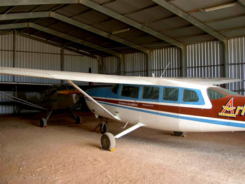
We stopped briefly at Arkaroola 'International Airport' to look at Doug's two airplanes.
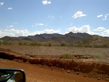
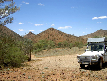
We reached the Southern Flinders Ranges,
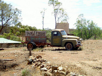
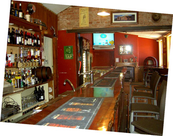
and dropped in at a local pub in Blinman for a cool beer
before making camp in the bush.
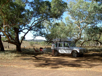
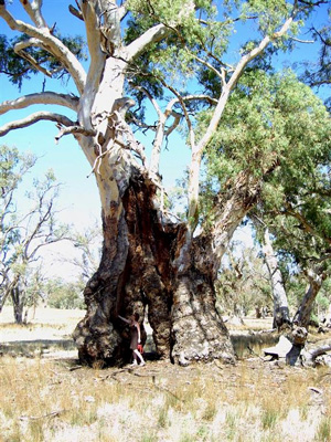
The area also had some gigantic eucalyptus trees.
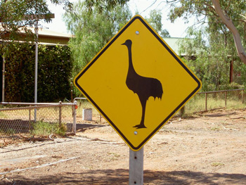
We were heading down to the coastline and the ocean at Port Augusta, which featured its own version of potential traffic hazards.
PART C: EYRE PENINSULA Point Gibbon GPS: S 33° 49' 32.2'' E 136° 46' 37.6''
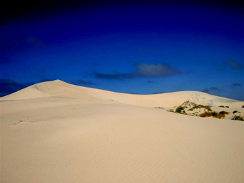
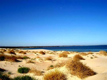
We reached the Eyre Peninsula during the first days in February and were urged by the local crew at Arkaroola to make the loop around it and to visit some of the beach spots they suggested. Tipped off by a local bar tender in Cowell we drove off to Point Gibbon on a 4WD road past the tiny homestead of Port Gibbon, and made camp between the rolling sand hills at the ocean.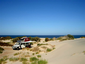
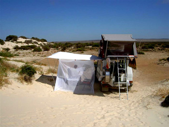
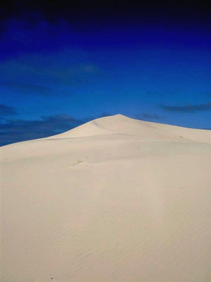
The area was as picturesque as you see it here and we decided to stay for a while and take it all in. There was not a soul in sight, other than a lone fisherman nearby, and we had the dunes,
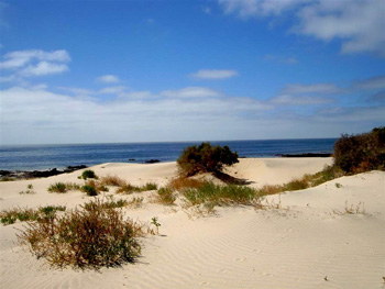
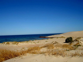
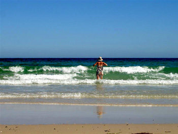
and the endless stretch of beach entirely to ourselves,
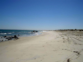
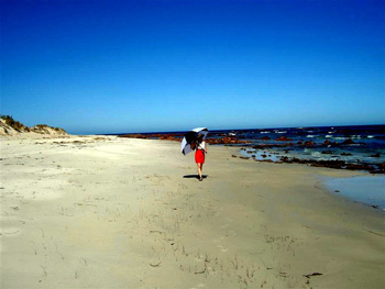
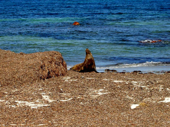
except for a seal who rested on the shore.
From here we enjoyed the view overlooking the bay to Port Gibbon and beyond.
From South Australia cheers to all of you until we'll check in again from Western Australia!