THE ROUTE
Sydney to Brisbane January 5 through 14 2009
Brisbane to Thargomindah: January 15 to January 26 2009
Thargomindah to eyre Peninsula
January 27th through February 7th 2009
Port Lincoln (South Australia) to Geraldton (Western Australia)
February 8th through March 7th 2009
Geraldton to Broome (Western Australia)
March 10th to April 10th 2009
Mileage since Sydney: 13600 KM
PART A: Kalbarri, Shark Bay and Kennedy Range
Happy Easter to all of you from the tropical city of Broome in the north-western tip of Western Australia! We are spending the Easter holiday here after a zig-zag journey between the coast and the interior from Geraldton to the Kimberley region.
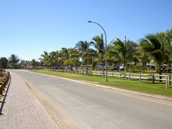
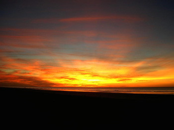
Also known as the sun-city, Geraldton is the largest urban centre in Western Australia (WA) north of Perth, and a major port for wheat and agricultural goods. We enjoyed it as a lovely city with street-side cafes, book shops, well stocked supermarkets, beautiful sunsets, and a complete absence of flies. We left the sun-city on March 10th heading north to Kalbarri, a coastal township at the entrance of the Kalbarri National Park.
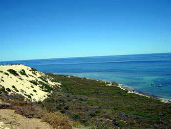
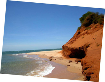
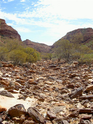
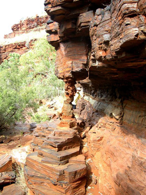
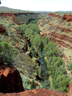
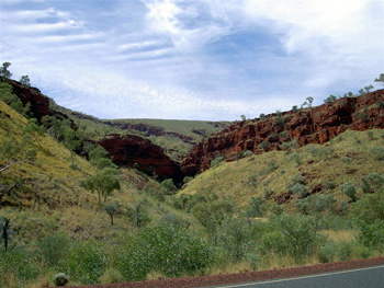
The Park consist of rugged cliffs along the coastline, dramatically carved away by forces of nature. Further inland, it encompasses some 1000 square km of bushland through which the Murchison River has carved out deep gorges on its way to the ocean.
At this time of the year, the park and the town of Kalbarri were almost deserted, only the flies hung around waiting for company.
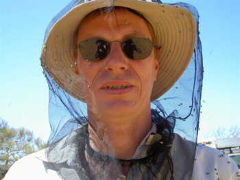
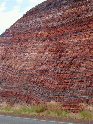
The avalanche of flies combined with the high day time temperatures hovering around 43° Celsius quickly put an end to our idea of hiking through the major sections of the Park. We opted for the drive-through version, even though inside our car it is as hot as outside of it (since we lack air-condition). But at least we gained an upper hand in the battle with flies. In Kalbarri NP, the red and white banded gorges, dotted with funky looking grass trees,
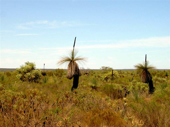
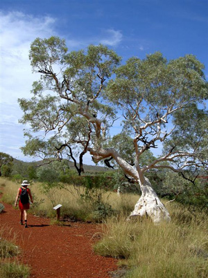
offer a stunning contrast to the deep blue of the ocean. The grass trees, which can reach a height of up to 6m, are one of the continent's botanical jewels. They grow extremely slow (0.5cm to 2cm per year) and are found throughout Western Australia as far north as Kalbarri. Because of their hairy tops consisting of a bunch of thin leaves and their dark, often burnt stems, they were called 'black boys' by early white settlers. Unfortunately, they won't grow in the cool climate of northern Germany, otherwise Gabi would have loved to bring some back to the garden in Hartenholm.
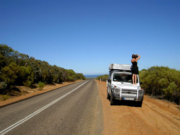
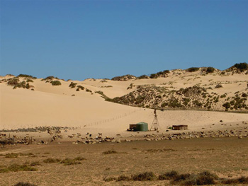
Between Perth and Geraldton the coast is being rapidly developed with myriads of housing estates, offering vacation homes for the urbanites of Perth. In a few years, this whole section of the ocean front will be turned into a suburb of Perth. From Geraldton onward, the West Australian coastline begins to unfold its pristine charm. It was only north of Geraldton that the coastal scenery changed and took on the remote character typical of the outback coastline of WA. We fell in love with it and decided to seek out some hidden away nooks along the Shark Bay area. What we found blew our expectations! We took a turn off the beaten track again and drove up 'Useless Loop', a sandy 4WD track leading eventually to the western most point of the continent. The track meanders along far removed from the tourist hub of Monkey Mia and its notoriously famous dolphins. We were not at all sure what to expect and already tired after a long and hot day on the road. When we pulled into Tamala Station we were looking for a place to set up camp and crash for the night.
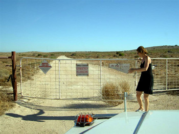
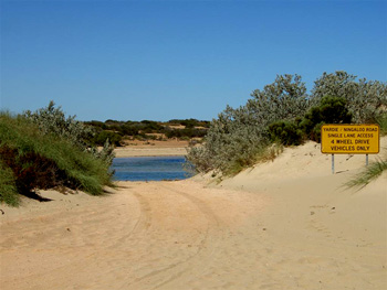
According to our map, the station offered a camp ground. There was nobody at the station when we arrived at the house, but a sign pointed with a big red arrow to a registration table on which we found a crudely drawn mud-map of the station land and all its locked gates, as well as paper pads to leave one's name and intended length of stay.
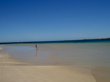
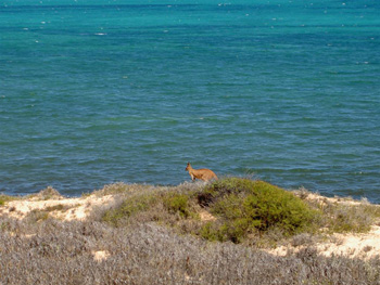
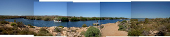
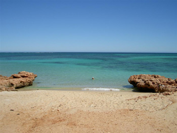
Next to the mud map lay sets of keys to all the gates leading onto the beaches and coast-line situated on station land. All in all, some 65 kilometers of coast and beaches accessible only to those who pick up keys to the gates from this remote former sheep station. We struggled through deciphering the mud map and trying to figure out which keys we may need for which gates and then left a note for the station managers, telling them where-abouts we would be heading and that we would pay the 13.20 $/person camping fees when we return the keys. Then, shortly before dusk, we set out to find a location. We arrived with the last light at Tea Tree point about 30km away from the station and several locked gates. And there we stood on the shore overlooking a series of four tranquil bays flickering with south-sea charm, blue waters, white sand, and not a soul in sight!
We had the whole area to ourselves for the whole duration of our stay. The waters were shallow and crystal clear. They harboured a nursery of young tiger sharks as well as different kinds of rays. The sharks were still small (about 30-40cm), curious, and quite harmless. We joked as we splashed about in the waters, saying that 'Hey, now we are swimming with the sharks!' The area was oozing such serenity and beauty that just waking up in the morning and looking out of the rooftop tent, made you feel like the luckiest person alive. We preserved water and food supplies in order to make our stay last for as long as we could stretch supplies. We stayed until our drinking water supplies had disappeared.
Back at the station buildings, we paid our bush-camp fees and chatted with the station managers (Brian and Jokie). Tamala station had been bought by a CEO from Perth a year ago. He employs Brian and Jokie to de-stock the station from feral goats (they are catching about 200 per week in traps at the watering holes). He wants to turn this remote wilderness into a luxury lodge offering all levels of amenities from top-end accommodation to camp-sites with facilities. In a couple years, we would no longer recognize our 'little paradise'. This process of turning remote and rugged regions into sites for touristic, industrial, and realty development is rapidly covering big chunks of Western Australia, from Perth to the Kimberleys.
After our stay on the beaches of Tamala station, Monkey Mia and its dolphins did not impress us much.
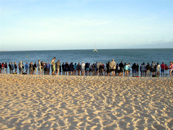
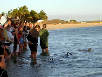
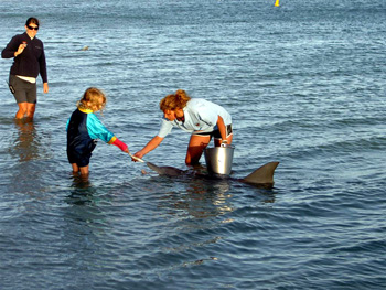
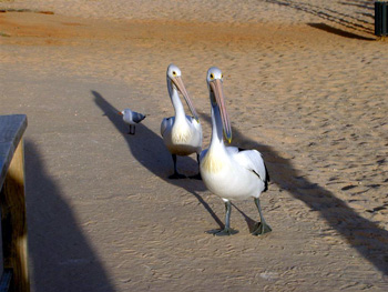
The dolphins are the primary attraction of Monkey Mia, a beach resort sorely lacking in charm, and the tourists flock there to watch the feeding of semi-wild dolphins, who swim to the shore each morning to get their breakfast fish at Monkey Mia Resort. We found the pelicans a tad more intriguing.
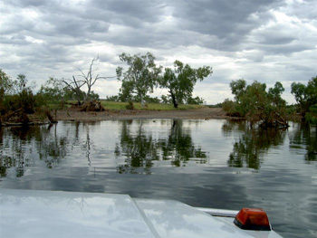
But the visit to Monkey Mia had forced us to get up very early from our cabin in Denham to drive to Monkey Mia and watch the dolphins arrive at 8AM. So we had the rest of the day to head out to Francis Peron National Park. It does not feature dolphins (nor for that matter crowds of people), but its soft sandy tracks
lead to a dramatic coastline
which provides a protected habitat for wild-life (turtles and birds), like this extensive colony of cormorans.
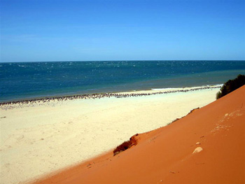
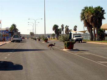
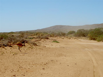
Francis Peron National Park delighted us with some true Outback coastal scenery: red sand dunes gently rolling into the bubbly ocean waters. It was a great place to search for shells and to watch birds. Nearby, in the small town of Denham, some wild-life has learned to navigate traffic successfully.
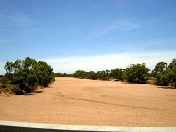
From Denham we continued north to Carnarvon in extreme heat (43° Celsius) and very dry weather conditions, with most of the rivers under the bridges being nothing but streams of dry sand.
[This temperature was still below our record temperature of 53° Celsius in the desert in Innaminka, when the diesel pumps at the service station refused to work due to the heat spell in January]. --------North of Carnarvon along the coast, we were still travelling in areas of water shortage. Here in the Gascoyne region, the rivers were running empty and fellow travellers with more ancient modes of transport had to search out the few remaining permanent water holes to 'fuel up'.
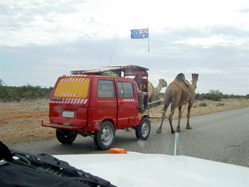
His license plate stated: 'Shit happens'! But whatever may have happened to him in the past, he obviously had made the best of his circumstances and was travelling through Australia in a camel drawn car. Like us, he was heading toward Rocky Pool
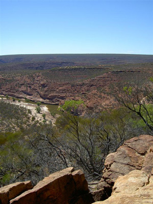
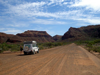
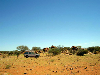
from where we continued on to the Kennedy Range, inland from Carnarvon. The Kennedy Range and its National Park are surrounded by a number of extremely large sheep stations, their size being indicative of how marginal these regions are for pastoralism and their low level of productivity. The sheep stations are part of the dry and barren plains covering the isolated Shire of Murchison, which measures some 43,800 square km and is the only Shire in Australia without a town. Even the big Lyons River carried all but a puddle of water.
The Kennedy Range itself is an ancient eroded plateau with cliffs rising up to 100 meters above the surrounding plains, and we actually found some marine fossils at the foot of its steep gorges. The heat was so intense even at 5pm that we could not bear to stand in one place for any length of time and we drove around until sun-down to avoid the flies and the numbing temperatures(45° Celsius).
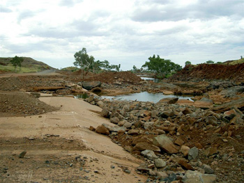
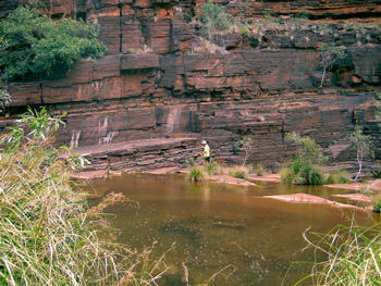
We had hoped for a welcome refreshing dip in the park's water pools or creeks, but everything had dried up and was sprinkled with dust (Dry Creek Crossing).
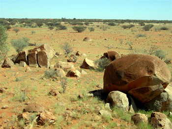
Nevertheless, the rocks were impressive and we camped there for the night before heading back to the coast through endless flat salt plains dotted with groups of enormous boulders.
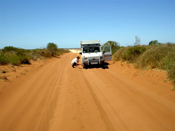
We encountered no other vehicle on the 300km track back to the North West Coastal Highway, and from there reaches Coral Bay and the southern extension of the Ningaloo Reef.
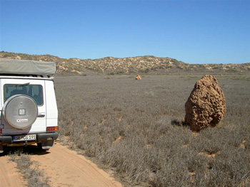
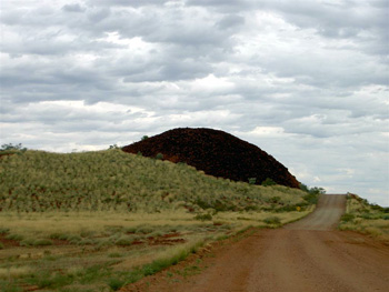
Coral Bay turns into a busy tourist centre between mid-April and October, and lies at the southern edge of the 260km coral reef. We stayed overnight on a campground and then continued north on deeply corrugated tracks over sheep station land. The area is home to many structures built by spinifex termite colonies.
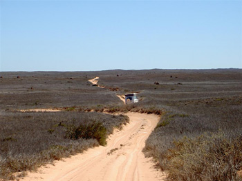
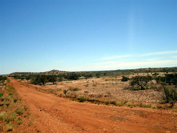
It is marginal pastoral land and the sheep have to cover considerable distances to walk between water bores to areas where they find some feed. Sand dunes are encroaching on land and also threaten the water holes for stocks.
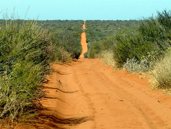
The 200km track from Coral Bay to the back entrance of Cape Range National Park features a bit of wild-life, but over-grazing by sheep and feral goats have pretty much destroyed indigenous vegetation.
Feral animals (such as introduced rabbits, cats, fox and camels, goats) are a major problem throughout Australia. Since they have no natural enemy they reproduce in large numbers and threaten indigenous wild-life (such as wallabies etc) or lead to a decline in local fauna. To control feral fox and cat populations vast areas of the countryside are covered with poisoned bait (Poison 1080/strychnine) to which local wild-life is resistant.
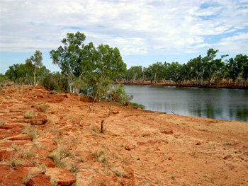
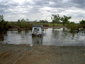
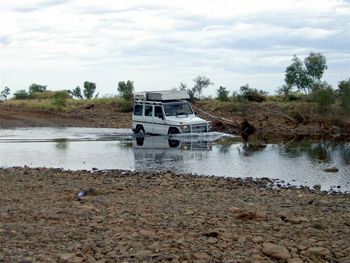
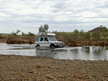
After the many months of dry rivers and creeks, we were taken aback when our sandy track suddenly disappeared into the shimmering waters of Yardie Creek.
This was a stark reminder that we had crossed the Tropic of Capricorn and had entered into the tropical and subtropical climate regions of the north. Thus, rivers and creek beds that previously had been dry, were now running high with water! The Yardie Creek crossing lies at the point where the river runs into the ocean waters. We decided to wait for low tide to attempt the crossing and used the time to prepare the car for its first salt water crossing
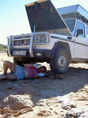
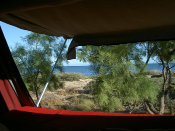
(Martin greasing the front axle to avoid salty water from penetrating the drive shaft casing). We made it across in good order and unaware that the road was officially closed and that days earlier several cars got badly bogged and had to be recovered by Road Side Assistance. We learned all this only the next day from the Park Ranger who came to our camp site just across the creek crossing (view from roof top tent).
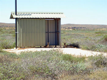
After crossing Yardie Creek, the track turned into a bitumen road suitable also for caravans. The Ranger explained that from May onward the whole of Cape Range National Park is packed with the caravans of the 'Grey Nomads' (retired people in their mobile homes) and will then no-longer resemble the deserted coastline we were able to enjoy (Osprey Bay).
For the avalanche of Grey Nomads new facilities had been constructed, such as these toilets, currently occupied by a pair of kangaroos.
Another heat-wave was approaching and we decided on a few days break and rented a lovely chalet overlooking the coastline 12 km out of Exmouth.
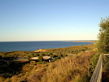
With 45° Celsius outside, we did nothing but rest, eat, sleep, and enjoy the air conditioned interior during the day and the cooler evenings on the patio -- for four days. The enormous water tanks next to our chalet reflect that water is precious in a country in which the ground water levels are not readily replenished. Rain water runs off for hundreds of miles along clay pans and does not drip into the ground but mostly evaporates. Water is the liquid gold and every drop is precious and collected.
B: Pilbara and Hammersley Range
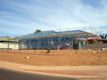
After sitting out the heat wave in the comfort of air-conditioned surroundings in Exmouth, we left the coast and headed inland; the course set for the Chichester and the Karijini National Park, deep in Pilbara country. The Pilbara region offers great diversity in scenery, including the moonscapes of the numerous and enormous mining projects for iron ore. The mining sites are rapidly changing the landscape in the interior as well as the atmosphere of coastal towns such as Karratha and Port Headland.
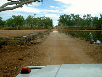
The further north we drove, the more water we encountered on the tracks, even though we ourselves had not yet enjoyed one full day of rain since arriving in Sydney in early January. Creeks were filled with run-off water from the heavy rainfall further up in the Kimberleys.
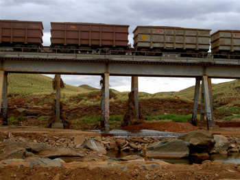
A major section of the road into Chichester National Park had been entirely washed away by recent flooding. We threaded our way across but stood in awe of the power of water when we saw the remains of the flood hanging 6 meters high on the railway bridge.
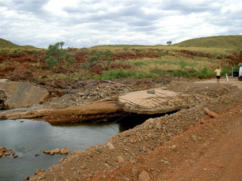
Some very ill-conceived advice by a woman in the Karratha tourist information centre had sent us struggling across this track. We had crossed several deep wash outs and flood areas before reaching this point here. Luckily, this was the last hazard before entering the National Park. Driving up on the other side of the wash out, we passed the sign 'Road Closed'. This news had not reached the Visitor's Centre in Karratha!
The Chichester Range is a rugged terrain of rolling spinifex hills, but not as spectacular as Karijini.
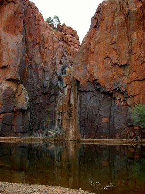
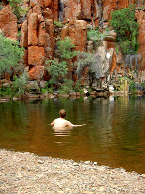
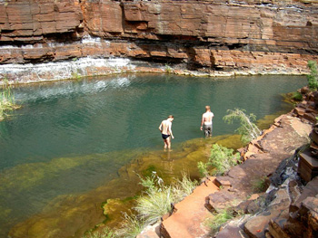
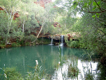
It has some permanent water pools, such as Python Pool, a sheer drop of red rock plunging into a fresh water pool (Python Pool).
The huge Iron Ore Mine at Tom Price, a couple of 100km away, has up-graded the connecting track into Karijini NP with its permanent water falls,
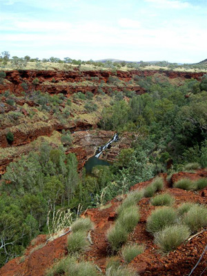
and deep gorges cut through the red rock walls over millions of years.
Gabi would have loved to pick up some of the rocks and bring them to her garden in Germany. But they proofed a couple of sizes too large, unfortunately.
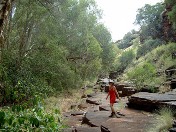
Rock walls, gorges, white paper-bark gum trees and quiet pools make up the heart of Karijini NP.
Making our way back to the coast to Port Headland, we left the ranges and its banded rock walls behind.
C: Coastline Port Headland to Broome
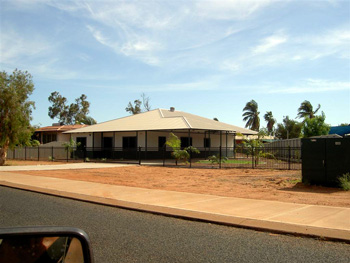
Port Headland, like Karratha, has developed into an ugly and rapidly spreading urban hub for mining operations in the Pilbara, and has astronomical real estate prices for a bit of land with a steel frame low-swung house ( this one listed for over half a million AUS $).
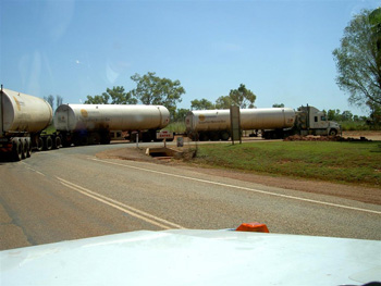
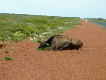
Both towns are places you want to leave as soon as possible after arriving there to stock up on supplies. Port Headland is the last hub for shopping before reaching Broome. The Great Northern Highway between Port Headland and Broome does not run close to the coast, and offers nothing but hours, hours, hours, hours, and hours of boring flat countryside to be crossed on a straight bitumen road with virtually no traffic. To pass time and avoid falling asleep, we counted the number road-side carcasses of kangaroos and cattle, and later the number of axles and tires of the only road train overtaking us (yes, there was only this one truck on the 300KM stretch of road and it was much faster than our GD --- all road trains are!). This one is featuring 19 axles with 78 tires. Quite a job to check the tyre pressure before the start of a trip.
Road trains are primarily responsible for road-side carcasses of stock.
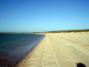
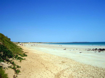
About 300km south of Broome, we pulled off the bitumen road and spent several days at Eighty Mile Beach Caravan Park, which was still in low season and had only 15 of its 275 camp sites occupied.
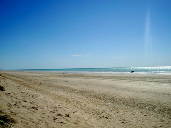
Lovely spot with endless, deserted miles and miles of beach ...
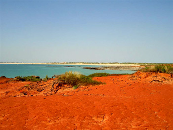
We reached Broome on April 9th, just for the full moon, and are enjoying its casual and laid back tropical flair. The coastline here displays the intense colours of the Kimberley region (red, white and blue). The beaches are a tad more crowded ⌣.
The Gibb River Road is still closed due to heavy rainfall in the Kimberleys and will remain so until the end of May. We have seen by now close to 14,000KM of landscape in Australia, some it very remote and most of it extremely beautiful and full of contrast. We have dropped the Gibb River Road from our list. It is now largely sealed and even features a bus services during dry season. Instead, we will be heading to Cape Leveque for a last stay at the Indian Ocean before commencing our long track across the desert: the heartland of the continent. We have now planned a route along the Canning Stock Route (entering it from the north) until it meets the Gary Junction Track, and then turning south onto Sandy Blight Track eventually reaching the Kings Canyon south of Alice Springs. We will then make our way back to the Pacific Coast. We obtained all necessary permits for Aboriginal Lands to cross on the route. We do not expect to have access to the internet again until we reach Alice Springs or Cairns. So, off we are once again, this time literally 'from Coast to Coast across the desert and the dead heart of the continent'.
Happy Easter and tidings of Spring to all of you on the northern hemisphere. Here Easter coincides with the season of autumn and shops are full of pears and pumpkins ...
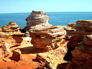
This is our farewell to the Indian Ocean and its spectacular beauty in the northern tip of Western Australia. A place of contrasts and colours, cliffs, coasts, sand and rock; connected by endless, flat plains stretching from one end of the horizon to the other:
Wild, beautiful ........
Next Route:
Cape Leveque and Gibb River Road
April 14th through April 28th 2009
February 8th through March 7th 2009
March 10th to April 10th 2009
PART A: Kalbarri, Shark Bay and Kennedy Range
April 14th through April 28th 2009